Cognaris Labs

Verified geospatial detection

AI that finds what the map is missing.

There are far more abandoned mine hazards, uncharted wrecks, and forgotten earthworks out there than the official records show. The evidence is already sitting in public sensor data. We built a system that finds it, checks its own work, and gives your field crews a short list of places actually worth visiting.
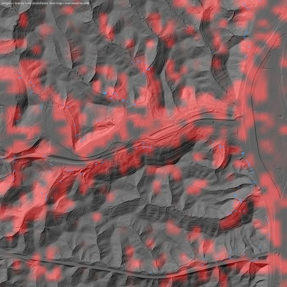
Bare-earth LiDAR hillshade of strip-mined terrain in Belmont County, Ohio, with red detection overlay and blue rings marking officially inventoried hazards
Belmont County, Ohio. A county — and a state — our model never trained on. We re-found 95% of the hazards in Ohio's official inventory. Red is our detection; the blue rings are the state's records.
99%
of known mine hazards re-found in Pennsylvania's anthracite belt — from LiDAR alone
89–97%
re-found in coal terrains the model was never trained on, across four states
6.1×
more disturbed acreage mapped than the official inventory has on record
100%
of our input data is public: USGS LiDAR, state records, NOAA archives

What we build

What we work on

Flagship · operational pilot

Abandoned Mine Lands

We use public LiDAR to fill out mine-hazard inventories: openings, highwalls, spoil piles, subsidence, and disturbed land that was never recorded anywhere. Evaluated across four states and four coal terrains, including counties the model never trained on.

state AML programsreclamation partners
Results & pilot offer →
In development

Maritime & Sonar

Automatic target recognition for side-scan and forward-looking sonar. We detect wrecks and obstructions in survey data and verify each one, and we're working toward running it in real time on board.

hydrographic surveydefense & NOAA
Our standards →
Research

Mineral Systems

Prospectivity modeling for critical-mineral exploration. We validate it with blind tests against known deposits — four geophysical belts so far.

critical mineralsexploration
The lab →

What you get

What actually lands on your desk

Coverage

Whole counties in days

We survey entire regions from public data, including terrain hidden under forest and ground no field crew could reasonably walk.

Verification

No raw AI output

Every candidate gets independently reviewed before you see it, so most of the noise never reaches your desk.

Evidence

A written case for every find

Each candidate comes with its imagery and a short explanation of why we think it's real. Field crews use it to plan visits; auditors like it too.

A note on how we operate

Every number we publish comes from ground our models had never seen, and we publish our limits along with our results. When something doesn't work, we say so. We have dropped whole product ideas because our own testing showed the signal wasn't there. Our standards →

Free pilot for reclamation partners

Pick an area you know well. We'll scan it at no cost, and you can grade what we find against what you already know is there.

Start a conversation